Difference between revisions of "File:Colonial haiti outline map.gif"
From TLP
m |
|||
| Line 1: | Line 1: | ||
| − | Outline Map of Colonial Haiti or St. Domingo | + | Outline Map of Colonial Haiti or St. Domingo <nowiki>[</nowiki>[[Saint-Domingue]]<nowiki>]</nowiki>. |
Source:<br> | Source:<br> | ||
Latest revision as of 06:45, 6 September 2006
Outline Map of Colonial Haiti or St. Domingo [Saint-Domingue].
Source:
Beard, J. R. (John Relly) (1863). Toussaint L'Ouverture: A Biography and Autobiography. Chapel Hill, NC: Academic Affairs Library, UNC-CH. Online Publication
The two-dimensional work of art depicted in this image is in the public domain in the United States and in those countries with a copyright term of life of the author plus 100 years. This photograph of the work is also in the public domain in the United States (see Bridgeman Art Library v. Corel Corp.).
File history
Click on a date/time to view the file as it appeared at that time.
| Date/Time | Thumbnail | Dimensions | User | Comment | |
|---|---|---|---|---|---|
| current | 06:26, 21 October 2005 | 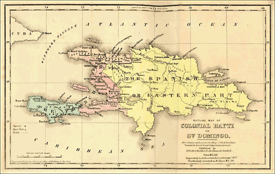 | 889 × 563 (221 KB) | Doe (talk | contribs) | Outline Map of Colonial Haiti or St. Domingo Source: {{Toussaint L'Ouverture: A Biography and Autobiography}} |
- You cannot overwrite this file.
File usage
The following page links to this file: