Difference between revisions of "Category:Maps"
From TLP
m (category indexing map images) |
m (added category) |
||
| Line 1: | Line 1: | ||
Maps and aerial photos relating to the [[Caribbean Sea]], [[Haiti]] and [[Saint-Domingue]]. | Maps and aerial photos relating to the [[Caribbean Sea]], [[Haiti]] and [[Saint-Domingue]]. | ||
| + | |||
| + | [[Category:Images]] | ||
Revision as of 08:22, 5 September 2006
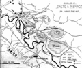
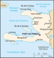
Maps and aerial photos relating to the Caribbean Sea, Haiti and Saint-Domingue.
Subcategories
This category has the following 2 subcategories, out of 2 total.
Media in category "Maps"
The following 21 files are in this category, out of 21 total.


