File:Partie francaise saint domi.gif
From TLP
Revision as of 08:43, 11 September 2007 by Doe (talk | contribs) (Reverted edits by 190.129.118.1 (Talk); changed back to last version by Doe)

Size of this preview: 800 × 556 pixels. Other resolutions: 320 × 222 pixels | 1,800 × 1,250 pixels.
Original file (1,800 × 1,250 pixels, file size: 406 KB, MIME type: image/gif)
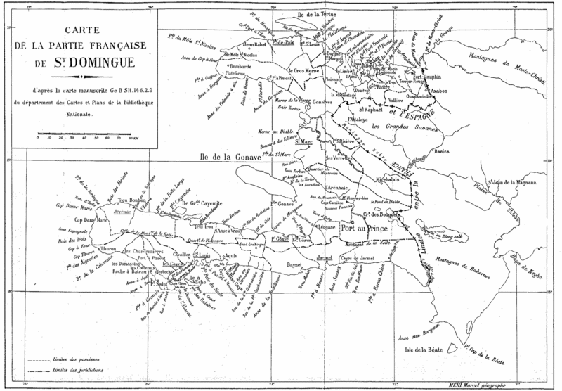
French map of Saint Domingue by Marcel Mehl, showing the 1777 boundaries within the French colony.
Title: Carte de la partie française de St. Domingue
d'après la carte manuscrite Ge B SH.146.2.9
du département des Cartes et Plans de la Bibliothèque Nationale.
Note: load the high resolution image for a better view.
The two-dimensional work of art depicted in this image is in the public domain in the United States and in those countries with a copyright term of life of the author plus 100 years. This photograph of the work is also in the public domain in the United States (see Bridgeman Art Library v. Corel Corp.).
File history
Click on a date/time to view the file as it appeared at that time.
| Date/Time | Thumbnail | Dimensions | User | Comment | |
|---|---|---|---|---|---|
| current | 10:56, 5 December 2005 | | 1,800 × 1,250 (406 KB) | Doe (talk | contribs) | French map of Saint Domingue by Marcel Mehl, showing the boundaries within the French colony. <br><br> Title:Carte de la partie française de St. Domingue<br> d'après la carte manuscrite Ge B SH.146.2.9<br> du département des Cartes et Plans de la B |
- You cannot overwrite this file.
File usage
The following 3 pages link to this file: