Difference between revisions of "File:Louisiana purchase map.jpg"
From TLP
m (added info on map origins) |
(spacing) |
||
| Line 1: | Line 1: | ||
Map of the territory acquired through the [[The Louisiana Purchase]]. | Map of the territory acquired through the [[The Louisiana Purchase]]. | ||
| − | From Frank Bond,''Louisiana and the Louisiana Purchase''. Washington, Government Printing Office, 1912. Map No. 4. | + | From Frank Bond, ''Louisiana and the Louisiana Purchase''. Washington, Government Printing Office, 1912. Map No. 4. |
Revision as of 10:38, 30 January 2006
Map of the territory acquired through the The Louisiana Purchase.
From Frank Bond, Louisiana and the Louisiana Purchase. Washington, Government Printing Office, 1912. Map No. 4.
File history
Click on a date/time to view the file as it appeared at that time.
| Date/Time | Thumbnail | Dimensions | User | Comment | |
|---|---|---|---|---|---|
| current | 10:08, 7 December 2005 | 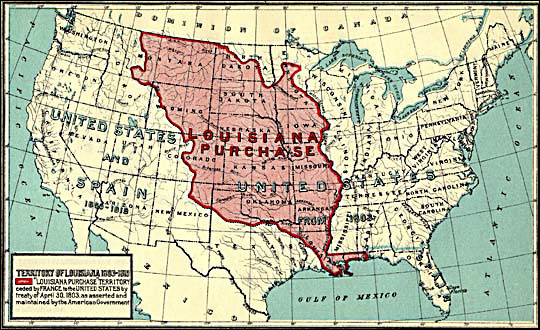 | 540 × 330 (88 KB) | Doe (talk | contribs) | 1912 map by Frank Bond of the territory acquired through the Louisiana purchase. |
- You cannot overwrite this file.
File usage
The following 2 pages link to this file: