File:Louisiana purchase map.jpg
From TLP
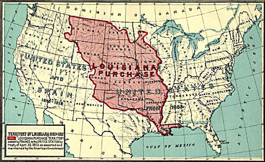
Revision as of 10:08, 7 December 2005 by Doe (talk | contribs) (1912 map by Frank Bond of the territory acquired through the Louisiana purchase.)
No higher resolution available.
Louisiana_purchase_map.jpg (540 × 330 pixels, file size: 88 KB, MIME type: image/jpeg)
1912 map by Frank Bond of the territory acquired through the Louisiana purchase.
File history
Click on a date/time to view the file as it appeared at that time.
| Date/Time | Thumbnail | Dimensions | User | Comment | |
|---|---|---|---|---|---|
| current | 10:08, 7 December 2005 | | 540 × 330 (88 KB) | Doe (talk | contribs) | 1912 map by Frank Bond of the territory acquired through the Louisiana purchase. |
- You cannot overwrite this file.
File usage
The following 2 pages link to this file: